Please contact me if you would like to download a map of the High Five Trail.
The High Five trail is rather short. We made the return hike in about an hour, allowing some time at the summit to take in the view but otherwise steady walking.
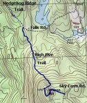
Wilson Hill, also known as High Five, is the southernmost high point of a ridge that extends over Hogden Pasture, Hedgehog Mt to Little Hedgehog Mt in the north. This long ridge separates West Deering from the rest of the town and there is no direct route from central Deering to West Deering. The ridge also forms the western boundary of a long wetland that drains to the north into the Contoocook River by Manselville Brook and to the south into the Reservoir and from there into the north branch of the Piscataquog River. The eastern bound of this wetland is dominated by Clark Summit.
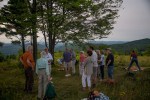
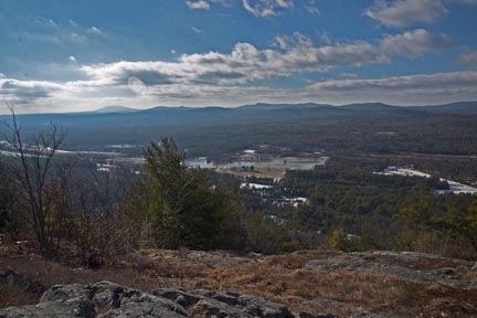
Wilson Hill, at 1400 ft, is the second highest point in Deering, behind Clark Summit. But, the panoramic views of Mt Monadnock in the southwest to Mt Lovewell in the north are delightfully accessible by a fairly easy walk of about 1/3 mile from Sky Farm Rd, or a somewhat more strenuous ramble from Falls Rd. Wilson Hill is really an open pasture with a few trees. Apart from the ticks, that are found everywhere here, it provides an excellent setting for a picnic (remember though, NO FIRES). The summit is an excellent place for star gazing!
There is limited space for parking at both ends of the High Five trail, but especially so at the Falls Rd. end. Sky Farm road is wide and relatively little traveled, thus offering reasonable space for on-road parking.
Sky Farm Rd is located at the southern end of Old County, opposite the point where Reservoir Rd meets Old County Rd. The entrance to the ‘High Five Reservation’ is about 3/4 mi from Old County/Reservoir Rds on Sky Farm Rd. It is marked by a Society for the Protection of New Hampshire Forests sign; the wide trail is blocked by a metal gate. Access to Wilson Hill is over a gently sloping dirt road which first passes through forest and then breaks into the open at the summit.
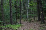
A maple tree at the summit indicates the opening for the Hedgehog Ridge Trail, which leads from Wilson Hill down to Falls Rd and then back up onto Hedgehog Ridge and, ultimately, Hedgehog Mt. Rd in the north. The trail to Falls Rd from the summit is well marked with yellow blazes and thus is easily followed. The climb down from the summit is a little sharp over 100 yards or so, but once it enters the forest the slope becomes gradual until reaching a brook. After a short climb from the brook, the trail is level to Falls Rd. The Hedgehog Ridge trail continues immediately across Falls Rd.
The return hike from Falls Rd to Wilson Hill is an easy, not too strenuous afternoon’s walk. There are lots of mushrooms in season, ferns, and clubmosses growing along the trail.
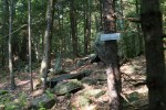
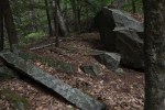
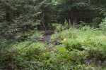
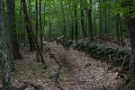
Sites of interest along the trail include rock walls and some impressively large trees. There are two small tupelo trees on the north side of the brook, alongside the trail. About mid way between Falls Rd and the brook there is some quarried granite that are worth a stop. The land was purchased by Beatrice Trum Humter and Stephen Hunter from the Gingras Brothers late in the 1940’s. The Gingras brothers operated a mica mine, which can be seen off the trail south of the brook. The mine is not very impressive although there are pieces of mica, along with remnants of the mining operation (visible from the trail). The brook flows south toward the Contoocook River. It is fun to follow for the small ponds and one largish beaver dam. Along the brook, not far from where the trail crosses, interesting flowering plants grow in the wetland. In short, the brook gives a great opportunity for ‘naturalizing.’
The trees along the trail are worth contemplating. Many started out as seedlings growing from rocks or fallen trees. Today the rock is gone, the old tree rotted away, leaving the large roots as props for the grown-up tree. In other cases large old oaks can be seen to have grown up from stump sprouts many years ago, their bases conjoined; they are like old brothers at the county fair. One youngish hardwood I saw yesterday had become bowed, forming an arc, the branches on the outside of the arc are now growing straight up. In time they too will appear as old siblings!